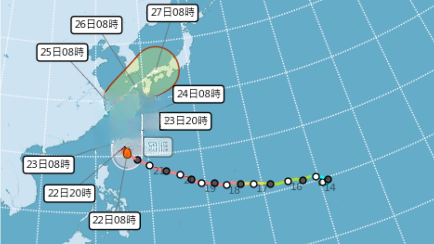
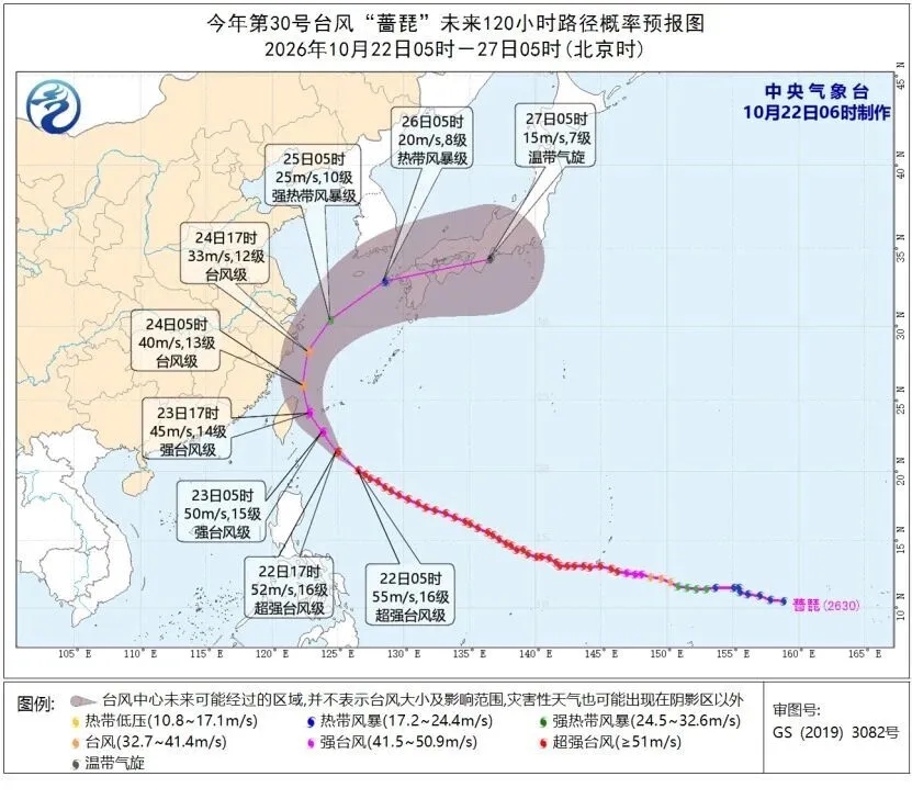
Typhoon Narijim has shifted its path significantly westward, with the Taiwan authorities expected to issue landfall warnings as early as today's noon. The storm's eye is projected to touch land by early tomorrow morning, and by afternoon, it will cover the entire island, bringing the strongest winds.
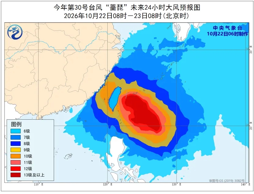
Starting late today, northern Taiwan will experience severe weather with winds peaking at 12 to 14 on the Beaufort scale by 4 AM tomorrow. The outer winds and associated effects from Typhoon Narijim will bring heavy downpours to the northeastern coast, with some areas expecting very heavy rainfall capable of causing disasters.
Residents in northern Taiwan and visitors are advised to take precautions, especially against extreme rainfall. Taiwan's eastern mountainous areas, especially along the northern coast, are at high risk of flash floods and landslides due to the typhoon's influence.